 Lýsigagnagátt
Type of resources
Available actions
Topics
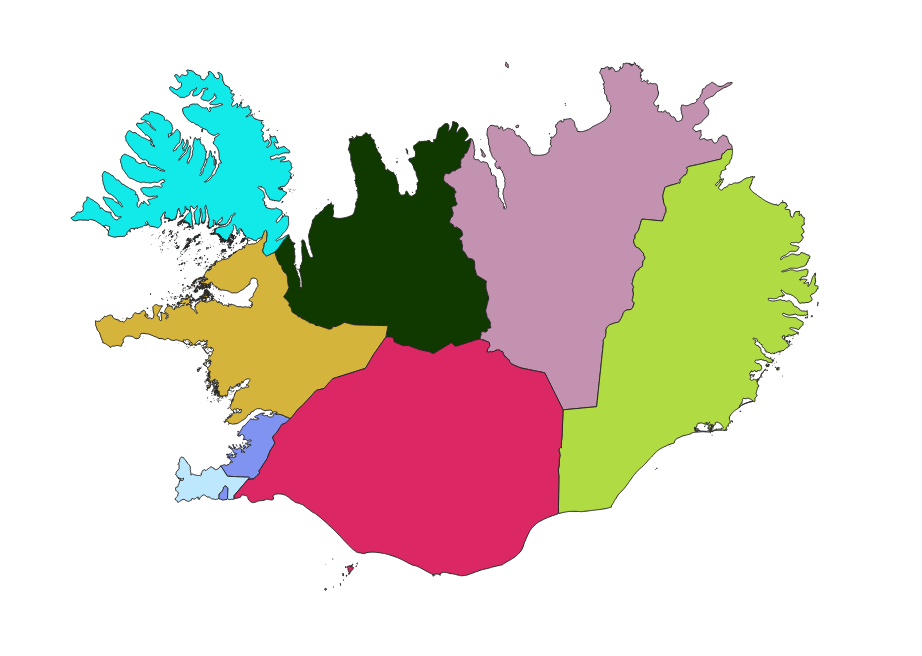
INSPIRE themes
Keywords
Contact for the resource
Provided by
Years
Formats
Representation types
Update frequencies
status
Service types
Scale
Resolution
-

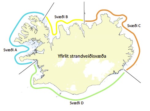
Vegagerðin annast rekstur landsvitakerfisins og hefur umsjón og eftirlit með uppbyggingu hafnarvita og innsiglingarmerkja. Landsvitar eru til leiðbeiningar á almennum siglingaleiðum og eru í eigu og umsjá ríkisins en hafnarvitar, sem vísa leið inn til hafnar eða eru innan hafnsögu hafnar, eru í eigu og umsjá sveitarfélaga. Landsvitakerfið samanstendur af 104 ljósvitum, 11 siglingaduflum og 16 radarsvörum sem er komið fyrir þar sem landslagi er þannig háttað að erfitt er að ná fram endurvarpi á ratsjá skipa. Hafnarvitakerfið er byggt upp af tæplega 20 ljósvitum, um 90 innsiglingarljósum á garðsendum og bryggjum, rúmlega 80 leiðarljósalínum og tæplega 50 baujum er vísa leið í innsiglingum að höfnum. Viðhald og eftirlit Vegagerðarinnar með vitum landsins skiptist í stórum dráttum í eftirlit með ljósabúnaði og viðhald á vitabyggingum.
-
Vinsamlega hafið samband við Fiskistofu vegna nánari upplýsinga.
-
Gagnasafn (GDB) NI_G1v_lupina_3.utg: Útbreiðsla alaskalúpínu á Íslandi, 3. útgáfa. [Nootka lupin coverage of Iceland, 3rd edition.] Endurskoðað kortlagningu á útbreiðslu alaskalúpínu á landinu, flákalag. Alaskalúpína (Lupinus nootkatensis), sem skilgreind er sem ágeng, framandi plöntutegund hér á landi, er orðin mjög útbreidd og þekur víða stór svæði. Hún veldur miklum breytingum á náttúrufari þar sem hún breiðist um.
-
Þekja (layer) j100v_austurland_gigar_1utg_li: Útlínur öskjurima útkulnaðra megineldsstöðva. [Outlines of calderas of extinct volcanos.] Útlínur miða við höggun, dreifingu þursabergs og móbergsmyndana. [The lines are based on local tectonics, distribution of agglomerates and hyaloclastites.]
-

Vinsamlega hafið samband við Hafrannsóknastofnun vegna nánanri upplýsinga.
-

ECMWF is the European Centre for Medium-Range Weather Forecasts. Both a research institute and a 24/7 operational service, producing global numerical weather predictions and other data for our Member and Co-operating States and the broader community. The Centre has one of the largest supercomputer facilities and meteorological data archives in the world. Other strategic activities include delivering advanced training and assisting the WMO in implementing its programmes. A key player in Copernicus, the Earth Observation component of the European Union’s Space programme, offering quality-assured information on climate change (Copernicus Climate Change Service), atmospheric composition (Copernicus Atmosphere Monitoring Service), flooding and fire danger (Copernicus Emergency Management Service), and through the EU's Destination Earth initiative, we are developing prototype digital twins of the Earth. The organisation was established in 1975 and now employs around 450 staff from more than 35 countries. ECMWF is one of the six members of the Co-ordinated Organisations, which also include the North Atlantic Treaty Organisation (NATO), the Council of Europe (CoE), the European Space Agency (ESA), the Organisation for Economic Co-operation and Development (OECD), and the European Organisation for the Exploitation of Meteorological Satellites (EUMETSAT). This page contains information how to access data of the ECMWF.
-
Þekja (layer) j100v_austurland_steingervingar_1utg_p: Fundarstaðir steingervinga. [Locations with fossils.] Fundarstaðir steingervinga, einkum plöntusteingervinga eða surtabrands. [Location with fossils, exclusvely plant fossils or lignite deposits.]
-

Umsóknin um Þingvelli á heimsminjaskrá var lögð fram í febrúar 2003 og var hún samþykkt á fundi heimsminjanefndar UNESCO í júlí 2004. Þingvellir eru þjóðgarður sem var með lögum stofnaður árið 1930.
-
Íslandi er skipt upp í loftgæðasvæði og bera heilbrigðiseftirlit viðkomandi svæða ábyrgð á því að ekki sé farið yfir mörk þar, og áætlunum um hvernig bregðast á við ef farið er yfir mörk.
-
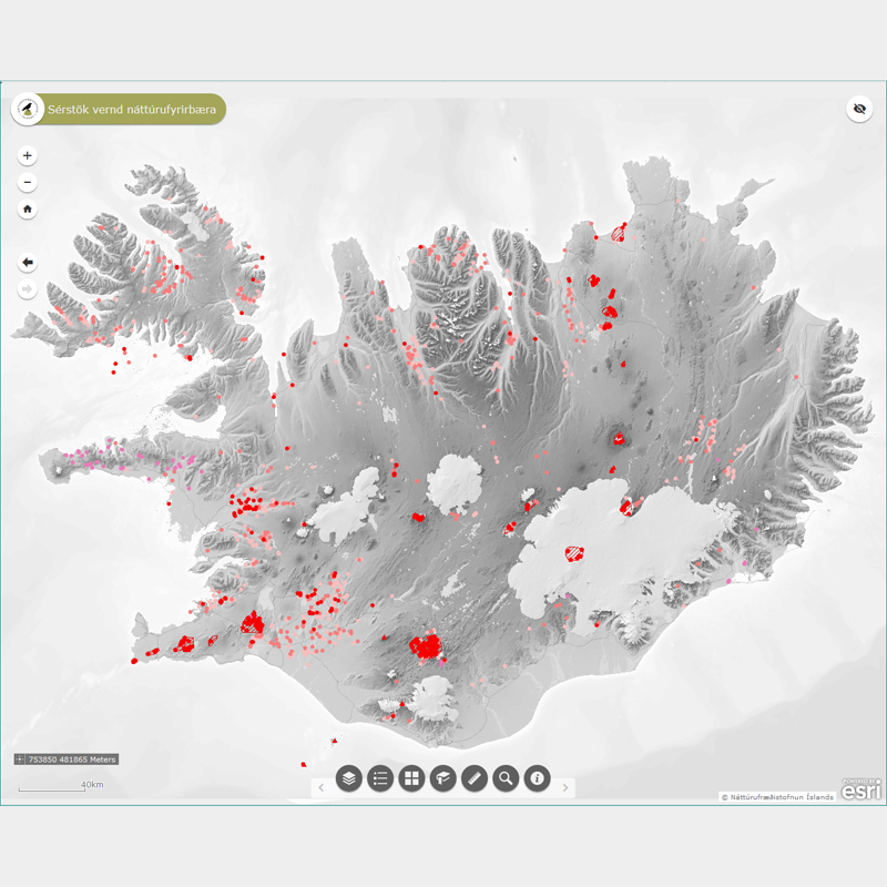
Þekja (layer) n500v_jadhiti_p og n500v_jardhiti_fl: Hverir og aðrar heitar uppsprettur. (Hot springs and other wells.) Hverir og aðrar heitar uppsprettur ásamt lífríki sem tengist þeim, virkri ummyndun og útfellingum, þar á meðal hrúðri og hrúðurbreiðum njóta sérstakrar verndar samkvæmt 61 gr. í lögum um náttúruvernd. Náttúrufræðistofnun Íslands heldur skrá yfir þessi náttúrufyrirbæri og birtir í kortasjá sem jafnframt er viðauki við náttúruminjaskrá. Jarðhitakort af Íslandi frá árinu 2003 eru einu aðgengilegu gögnin fyrir þetta náttúrufyrirbæri og sem ná yfir allt landið. Upplýsingar um lífríki, ummyndun og útfellingar hefur ekki verið safnað saman og fylgir ekki með gögnunum.