 Lýsigagnagátt
100000
Type of resources
Available actions
Topics
INSPIRE themes
Keywords
Contact for the resource
Provided by
Years
Formats
Representation types
Update frequencies
status
Scale
-
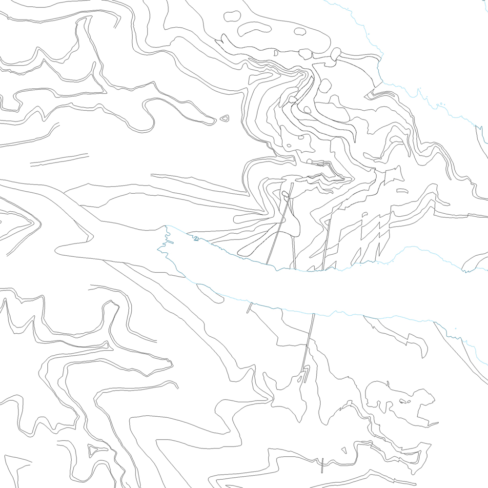
Þekja [layer] j100v_vesturgosbelti_berggrunnurNidurfoll_1utg_fl: Niðurföll í nútímahraunum. [Collapse pits in Holocene lavas.}
-
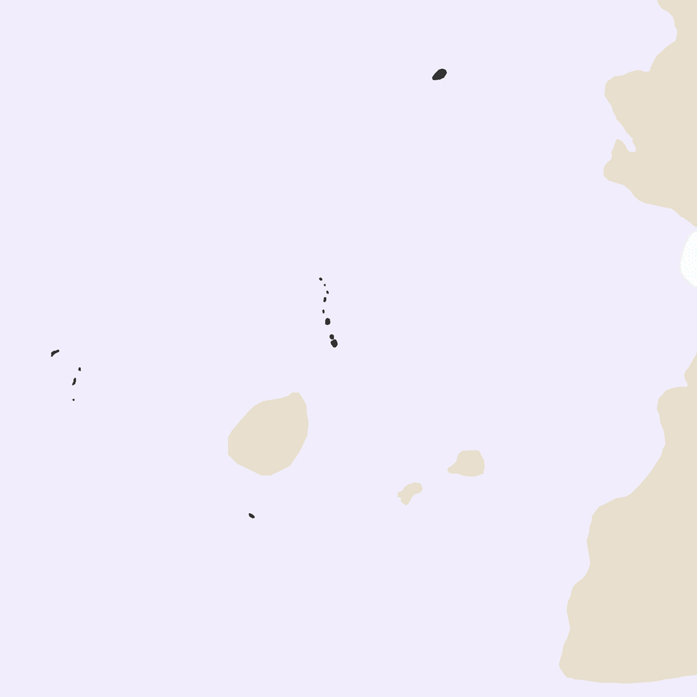
Landhelgi Íslands er skilgreind í lögum nr. 41/1979 með síðari breytingum frá 15. október 2021. Heiti laganna er Lög um landhelgi, aðlægt belti, efnahagslögsögu og landgrunn. Í lögunum eru skilgreiningar og útskýringar á aðlægu belti, efnahagslögsögu og landgrunni Íslands: https://www.althingi.is/lagas/nuna/1979041.html Landhelgi Íslands skal afmörkuð af línu sem alls staðar er 12 sjómílur frá grunnlínu. Grunnlína er sett fram sem lína en einnig punktar. Línan er dregin milli punktanna. Aðlægt belti er svæði utan landhelgi (línur). Efnahagslögsaga Íslands er svæði utan landhelgi (línur). Vinsamlega hafið samband við Landhelgisgæslu Íslands vegna nánari upplýsinga.
-
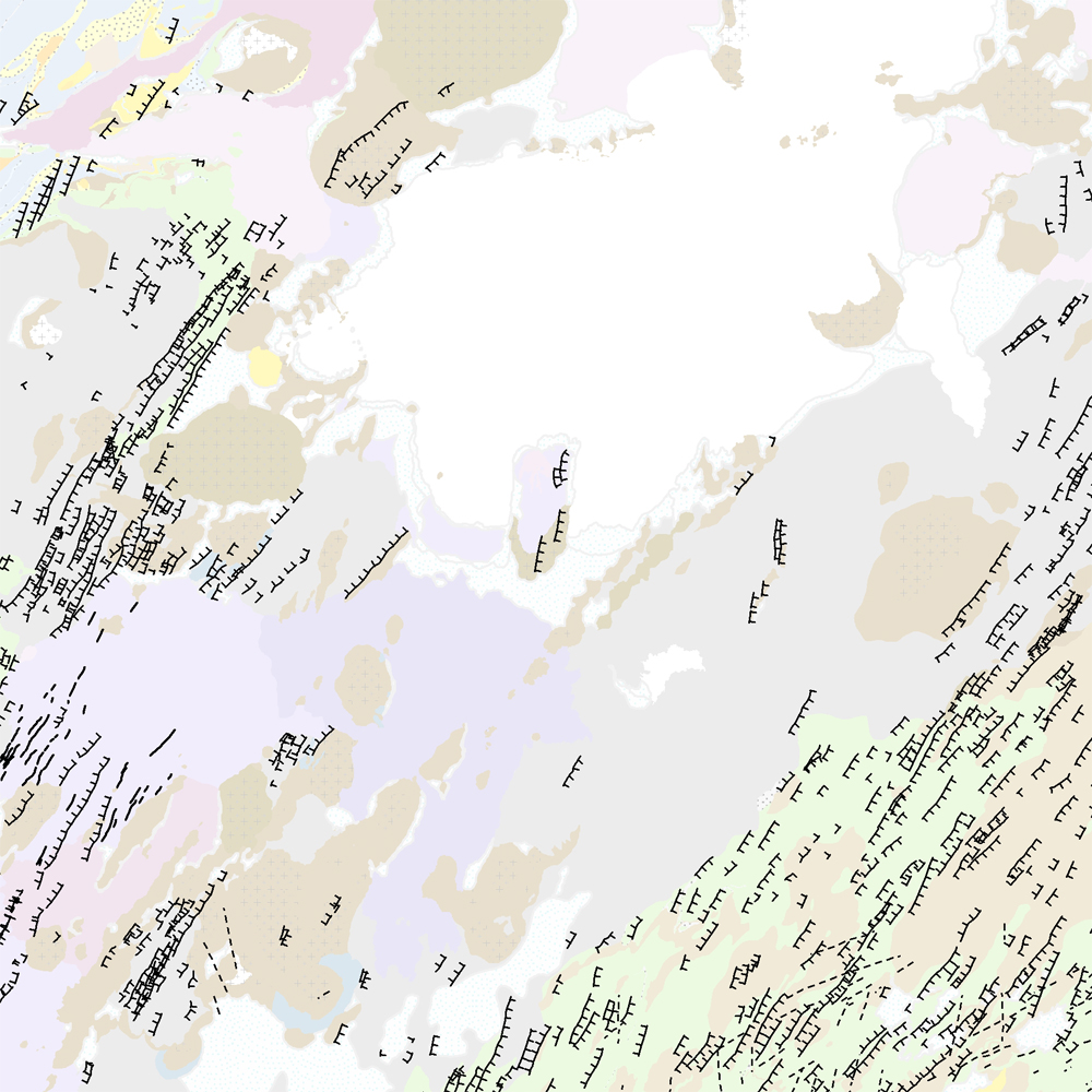
Þekja (layer) j100v_austurland_millilog_1utg_li:: Gjóskulög á Austfjörðum. [Tuff layers in Eastern Iceland.] Línur sýna staðsetningu stærstu gjóskulagana á Austfjörðum. Gjóskulögin eru fengin úr ýmsum kortum og kortlagningu Birgis V. Óskarssonar. Gögn eru flokkuð eftir ÍST120:2012 staðlinum, nema þrjá fitjueigindir: myndunKodi = Heiti myndunarinnar (skammstöfun) myndunIS = Heiti myndunarinnar (á íslenskuc) myndunEN = Heiti myndunarinnart (á ensku) [Lines show the location of largest tuff deposits in Eastern Iceland. The tuff layers are derived from older maps and the mapping of Birgir V. Óskarsson. The data follows the ÍST120:2012 data standard with the three additional feature attributes: myndunKodi = Lithostratigraphic unit (abbreviation) myndunIS = Lithostratigraphic unit (in Icelandic) myndunEN = Lithostratigraphic unit (in English)]
-
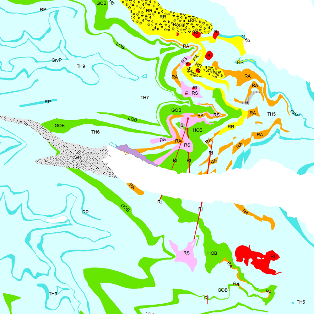
Þekja [layer] j100v_vesturgosbelti_berggrunnur_1utg_li: Línur sýna viss og óviss mörk berggrunns og hraunjaðars ásamt hrauntröðum. [Lines showing certain and uncertain boundaries of bedrock and borders of lava fields, including lava channels.] Mörk tilheyra flákagögnum 'ni_j100v Berggrunnur á Vesturgosbelti – 1:100.000' (þekja j100v_vesturgosbelti_berggrunnur_1utg_fl). Nýr kóði fyrir fitjueigindina 'Jarðmyndun og landmótun lausra jarðefna' (jardmLandmJardefna): hram05 = hrauntröð brún. [Boundaries follow the polygon data 'ni_j100v Berggrunnur á Vesturgosbelti – 1:100.000' (layer j100v_vesturgosbelti_berggrunnur_1utg_fl). New code for feature attribute 'Jarðmyndun og landmótun lausra jarðefna' (jardmLandmJardefna): hram05 = lava channel edge.]
-
Þekja [layer] j100v_vesturgosbelti_jardgrunnur_1utg_fl: Jarðgrunnsgögn af Vesturgosbelti Íslands. [Surface deposits of the Western Volcanic Zone of Iceland.] Laus setlög, svo sem jökulgarðar og árset. [Unconsolidated sediments including glacial morianes and river sediments.]
-
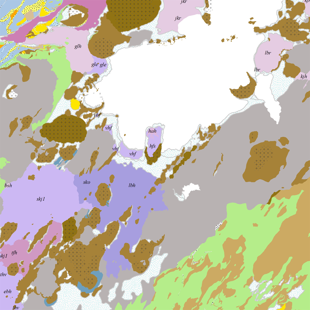
Þekja (layer) j100v_austurland_berggrunnur_1utg_fl: Gögn sem sýnir bergrunn Austurlands. [Data showing the bedrock geology of Eastern Iceland.] Flákalag með bergrunn Austurlands. Flákarnir sýna mismunandi gerðir storkubergs ásamt sethulu. Gögn eru flokkuð eftir ÍST120:2012 staðlinum, nema þrjá fitjueigindir: myndunKodi = Heiti myndunarinnar (skammstöfun) myndunIS = Heiti myndunarinnar (á íslenskuc) myndunEN = Heiti myndunarinnart (á ensku) Nýr kóði fyrir fitjueigindi 'Tegund storkubergs' (tegStorkubergs): shra = samsett hraun, dbas = Dílabasalt, dobas = Díla- og olívínbasalt, and = Andesít. [Polygone layer of the bedrock geology of Eastern Iceland. The polygones show different classes of intrusive and extrusive rocks and the sediment cover. The data follows the ÍST120:2012 data standard with the three additional feature attributes: myndunKodi = Lithostratigraphic unit (abbreviation) myndunIS = Lithostratigraphic unit (in Icelandic) myndunEN = Lithostratigraphic unit (in English) New codes for feature attribute 'Tegund storkubergs' (tegStorkubergs) are: shra = composit lava, dbas = porphyritic lava, dobas = porphyritic and olivine basalt, and = andesite.]
-
Þekja [layer] j100v_vesturgosbelti_berggrunnur_1utg_fl: Gögn fyrir berggrunn ásamt nútímahraunum. [Data showing the bedrock geology, including Holocene lavas.] Berggrunnur er flokkaður eftir aldri, gerð og samsetningu. Gögn eru flokkuð eftir ÍST120:2012 staðlinum, nema fitjueigindir: myndunKodi = stuttur kóði sem táknar gerð bergmyndunar, myndunIS = stutt íslenskt heiti fyrir bergmyndun, myndunEN = stutt enskt nafn á bergmyndun, eldstodNafn = nafn eldstöðvakerfis, kenni = stuttur kóði fyrir hlýskeiðishraun og nútímahraun, aldur = aldursbil, Nýr kóði fyrir fitjueigindina 'Tegund storkubergs' (tegStorkubergs): dbas = dílabasalt. [Bedrock is classified by age, type, and composition. The data follows the ÍST120:2012 data standard with these additional feature attributes: myndunKodi = short code denoting the rock formation type, myndunIS = short Icelandic name for rock formation, myndunEN = short English name for rock formation, eldstodNafn = name of the volcanic system, kenni = short codename for interglacial and postglacial lavas, aldur = age range. New code for feature attribute 'Tegund storkubergs' (tegStorkubergs): dbas = porphyrytic basalt.]
-
Þekja [layer] j100v_vesturgosbelti_hoggun_1utg_li: Höggun á Vesturgosbelti Íslands, línulag. [Tectonic of the Western Volcanic Zone Icelands, line features.] Gögn sýna sprungur, misgengi, gjár, mislægi og brotalínur, kortlagt í mkv. 1:100.000. [Tectonic line features such as faults, fractures, fissures, unconformity, and fracture lines mapped at 1:100,000 scale.]
-
Þekja (layer) j100v_austurland_berggrunnurMork_1utg_li: Línur sýna þekkt mörk berggrunns. [Lines showing certain boundaries of bedrock.] Tilheyra flákagögn 'ni_j100v Berggrunnur á Austurlandi – 1:100.000' (j100v_austurland_berggrunnur_1utg_fl). [Follows the polygon data 'ni_j100v Berggrunnur á Austurlandi – 1:100.000' (j100v_austurland_berggrunnur_1utg_fl).]
-
Þekja [layer] j100v_vesturgosbelti_gigar_1utg_fl: Gígar frá nútíma og hlýskeiðum ísaldar. [Holocene and interglacial lava craters.] Gígar frá nútíma og hlýskeiðum ísaldar. Gígar eru gjall- eða kleppragígar. [Holocene and interglacial lava craters. Craters may be spatter, scoria or tuff cones.]