 Lýsigagnagátt
geoscientificInformation
Type of resources
Available actions
Topics
INSPIRE themes
Keywords
Contact for the resource
Provided by
Years
Formats
Representation types
Update frequencies
status
Scale
Resolution
-
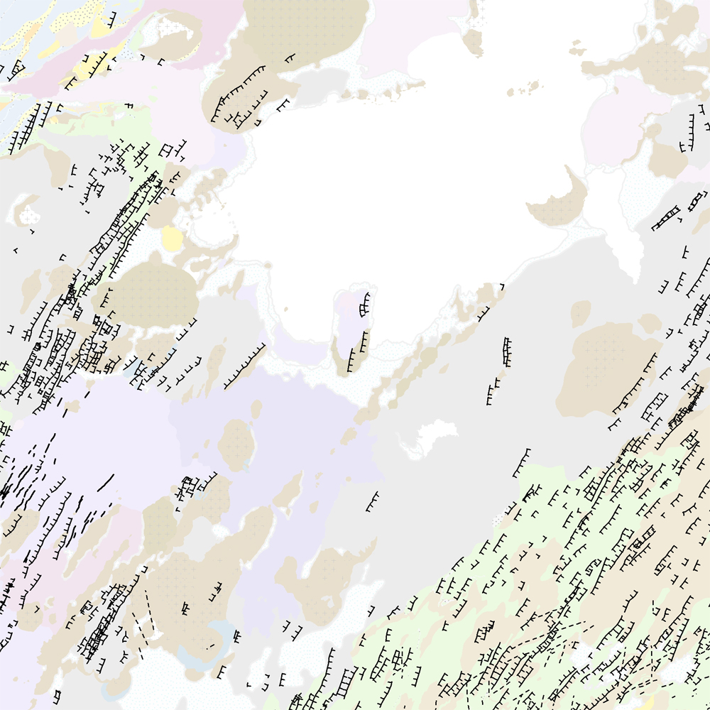
Þekja [layer] j100v_vesturgosbelti_hoggun_1utg_li: Höggun á Vesturgosbelti Íslands, línulag. [Tectonic of the Western Volcanic Zone Icelands, line features.] Gögn sýna sprungur, misgengi, gjár, mislægi og brotalínur, kortlagt í mkv. 1:100.000. [Tectonic line features such as faults, fractures, fissures, unconformity, and fracture lines mapped at 1:100,000 scale.]
-
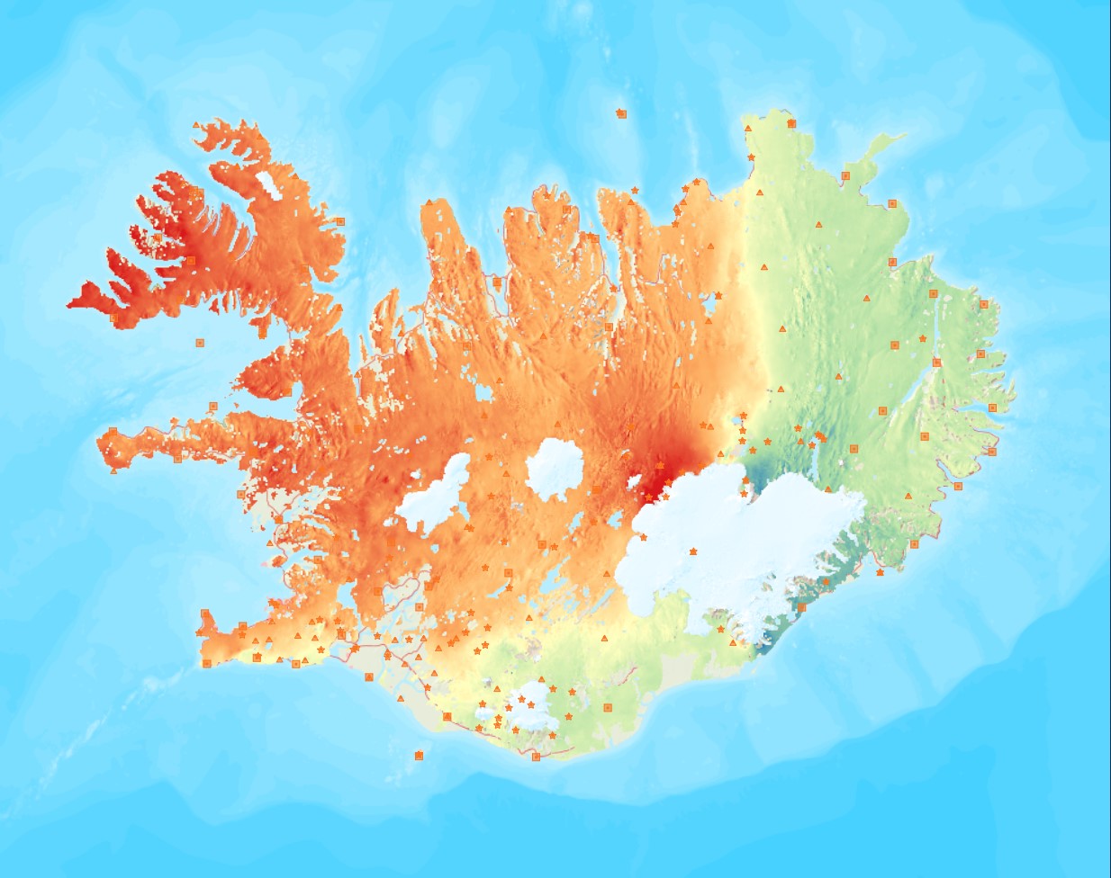
Average near-East crustal velocities between summer 2015 and summer 2018. These velocities indicate velocities in the East direction. However, they could be slightly influence by velocities along the North and Up directions and are therefore called near-East. Near-East velocities were derived by decomposing the line-of-sight velocities of six Sentinel-1 interferometric time-series covering Iceland. These time-series used a single master approach and Sentinel-1 images from the following summers (mid-June to end of September): 2015, 2016, 2017, and 2018. The near-East velocity grid has a 50 m resolution.
-
Þekja (layer) j100v_austurland_berggrunnur_1utg_fl: Gögn sem sýnir bergrunn Austurlands. [Data showing the bedrock geology of Eastern Iceland.] Flákalag með bergrunn Austurlands. Flákarnir sýna mismunandi gerðir storkubergs ásamt sethulu. Gögn eru flokkuð eftir ÍST120:2012 staðlinum, nema þrjá fitjueigindir: myndunKodi = Heiti myndunarinnar (skammstöfun) myndunIS = Heiti myndunarinnar (á íslenskuc) myndunEN = Heiti myndunarinnart (á ensku) Nýr kóði fyrir fitjueigindi 'Tegund storkubergs' (tegStorkubergs): shra = samsett hraun, dbas = Dílabasalt, dobas = Díla- og olívínbasalt, and = Andesít. [Polygone layer of the bedrock geology of Eastern Iceland. The polygones show different classes of intrusive and extrusive rocks and the sediment cover. The data follows the ÍST120:2012 data standard with the three additional feature attributes: myndunKodi = Lithostratigraphic unit (abbreviation) myndunIS = Lithostratigraphic unit (in Icelandic) myndunEN = Lithostratigraphic unit (in English) New codes for feature attribute 'Tegund storkubergs' (tegStorkubergs) are: shra = composit lava, dbas = porphyritic lava, dobas = porphyritic and olivine basalt, and = andesite.]
-
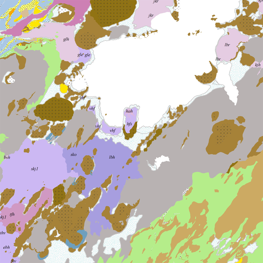
Þekja [layer] j100v_vesturgosbelti_berggrunnur_1utg_fl: Gögn fyrir berggrunn ásamt nútímahraunum. [Data showing the bedrock geology, including Holocene lavas.] Berggrunnur er flokkaður eftir aldri, gerð og samsetningu. Gögn eru flokkuð eftir ÍST120:2012 staðlinum, nema fitjueigindir: myndunKodi = stuttur kóði sem táknar gerð bergmyndunar, myndunIS = stutt íslenskt heiti fyrir bergmyndun, myndunEN = stutt enskt nafn á bergmyndun, eldstodNafn = nafn eldstöðvakerfis, kenni = stuttur kóði fyrir hlýskeiðishraun og nútímahraun, aldur = aldursbil, Nýr kóði fyrir fitjueigindina 'Tegund storkubergs' (tegStorkubergs): dbas = dílabasalt. [Bedrock is classified by age, type, and composition. The data follows the ÍST120:2012 data standard with these additional feature attributes: myndunKodi = short code denoting the rock formation type, myndunIS = short Icelandic name for rock formation, myndunEN = short English name for rock formation, eldstodNafn = name of the volcanic system, kenni = short codename for interglacial and postglacial lavas, aldur = age range. New code for feature attribute 'Tegund storkubergs' (tegStorkubergs): dbas = porphyrytic basalt.]
-
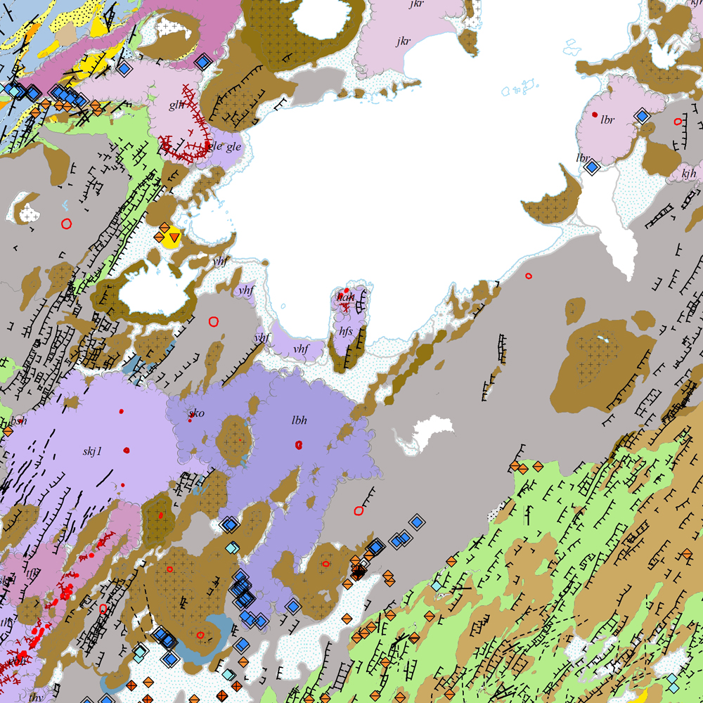
Gagnasafn [GDB] NI_J100v_Vesturgosbelt_1.utg: Jarðfræðikort af Vesturgosbelti Íslands í mælikvarði 1:100.00, 1. útg. [Geological map of the Western Volcanic Zone of Iceland in the scale of 1:100.000, 1st ed.] Kortið sýnir jarðlög, gíga, höggun, strik og halla, framhlaup og niðurföll, steingervinga, jökulrákir, jökulgarða, jökulkembur, malarása og fornar strandlínur stöðuvatna. Jarðlög eru flokkuð eftir aldri, gerð og samsetningu. Kortið var unnin í samstarfi Náttúrufræðistofnunar Íslands og Íslensku Orkurannsoknastofa. Tilvísun: Birgir V. Óskarsson, Ögmundur Erlendsson, Robert A. Askew, Árni Hjartarson, Magnús Á. Sigurgeirsson, Skafti Brynjólfsson og Sveinn Jakobsson 2022. Jarðfræðikort af Vesturgosbelti. 1.100.000. 1. útg. Garðabær: Náttúrufræðistofnun Íslands, Íslenskar Orkurannsóknir og Umhverfis- og Auðlindaráðuneytið. [The map displays bedrock geology, volcanic craters, tectonics, strike and dips, landslides and collapse pits, fossils, glacial striations, glacial moraines, flutes, eskers and ancient lake strandlines. Bedrock is classified by age, type, and composition. The map was completed in a collaborative project between the Icelandic Institute of Natural History and the Icelandic Geosurvey. Bibliographic reference: Birgir V. Óskarsson, Ögmundur Erlendsson, Robert A. Askew, Árni Hjartarson, Magnús Á. Sigurgeirsson, Skafti Brynjólfsson og Sveinn Jakobsson 2022. Geological map of the Western Volcanic Zone, Iceland. 1:100.000. 1st edition. Garðabær: Icelandic Institute of Natural History, Iceland GeoSurvey and Ministry for the Environment and Natural Resources.]
-
Þekja [layer] j100v_vesturgosbelti_gigar_1utg_p: Gervigígar, punktalag. [Rootless cones, point data.]
-
Average near-Up crustal velocities between summer 2015 and summer 2018. These velocities indicate velocities in the Up direction. However, they could be slightly influence by velocities along the East and North directions and are therefore called near-Up. Near-Up velocities were derived by decomposing the line-of-sight velocities of six Sentinel-1 interferometric time-series covering Iceland. These time-series used a single master approach and Sentinel-1 images from the following summers (mid-June to end of September): 2015, 2016, 2017, and 2018. The near-Up velocity grid has a 50 m resolution.
-

Þjónustan inniheldur staðsetningu og upplýsingar um borholur og gryfjur sem eru skráðar hjá Vegagerðinni.
-
Þekja [layer] j100v_vesturgosbelti_berggrunnurNidurfoll_1utg_fl: Niðurföll í nútímahraunum. [Collapse pits in Holocene lavas.}
-
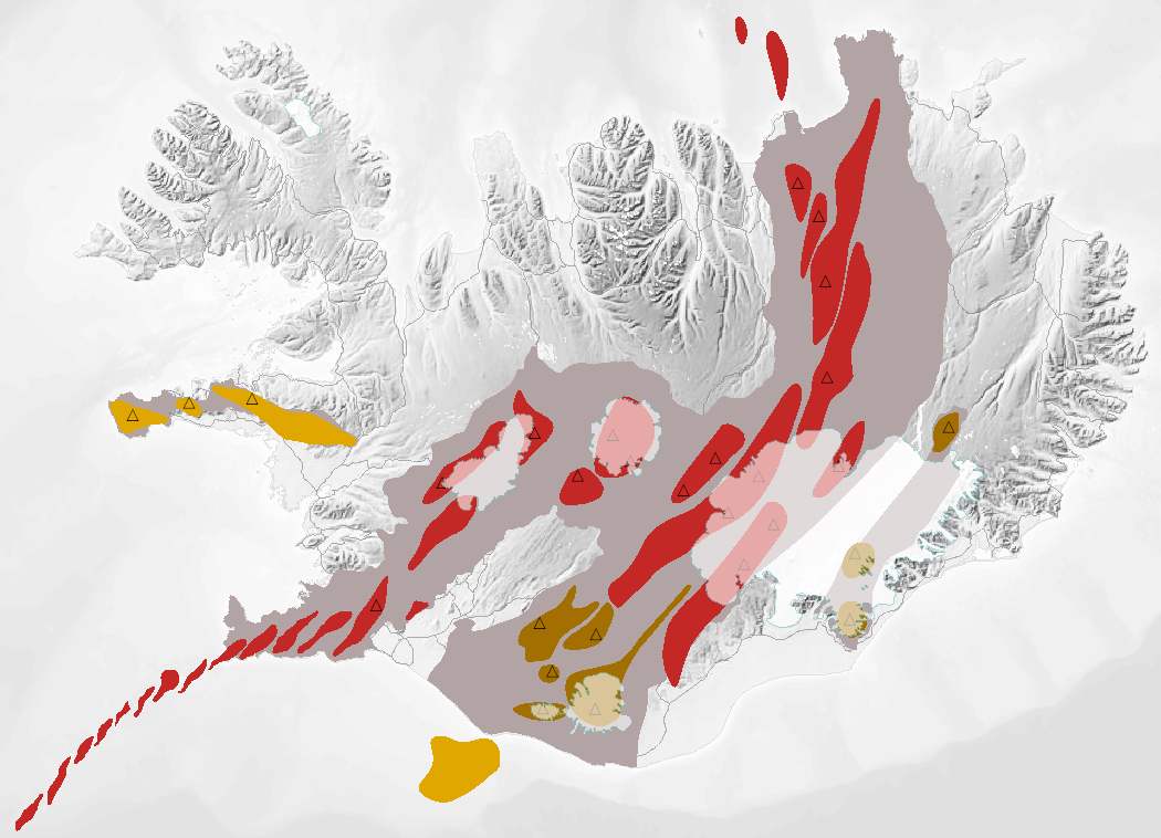
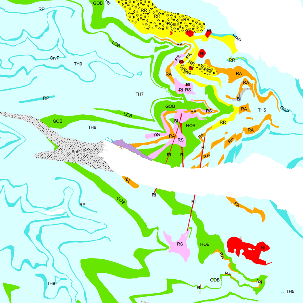
Gagnasafn (GDB) NI_J600v_bergradir_ISN93_1.utg: NI_J600v Bergraðir Íslands – 1:600.000 [NI_J600v Igneous rock series of Iceland – 1:600.000]. Kort af þremur bergröðum Íslands. Kortið sýnir virk gosbelti á Íslandi og landgrunni þess á nútíma og síðjökultíma, virk eldstöðvakerfi á nútíma, útbreiðslu gosstöðva og samsetningu gosbergs (flákalag). Staðsetning megineldstöðva er einnig sýnd (punktalag). Gerður er greinarmunur á þóleiískum, alkalískum og millibergskerfum. [The map of the three igneous rock series of Iceland at a scale of 1:600.000 shows the volcanic zones active in Iceland and its insular shelf during the Holocene and Late Pleistocene, volcanic systems active during the Holocene, the distribution of eruption sites and chemical composition of erupted rocks (polygon layer). The position of central volcanoes is also shown (point layer). Tholeiitic, alkalic and transitional alkalic volcanic systems are differentiated.]