 Lýsigagnagátt
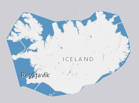
inlandWaters
Type of resources
Available actions
Topics
INSPIRE themes
Keywords
Contact for the resource
Provided by
Years
Formats
Representation types
Update frequencies
status
Scale
-

Útlínur hnitaðar af AMS kortum bandaríska hersins sem byggja á loftmyndum frá árunum 1945 og 1946. Útlínurnar hafa verið uppfærðar á nokkrum stöðum með skönnuðum, uppréttum loftmyndum úr safni Náttúrufræðistofnunar.
-

Staðsetning á mælistað fyrir afkomumælingar á jöklum á Íslandi. Samstarf Veðurstofu Íslands og Jarðvísindastofnun Háskóla Íslands.
-
Útlínur dregnar eftir Landsat og SPOT-5 gervihnattamyndum, uppréttum loftmyndum frá Loftmyndum ehf. og skáflugmyndum.
-
EN: Lake and coastal waterbodies in Iceland. "Lake" means a body of standing inland surface water. "Coastal water" means surface water on the landward side of a line, every point of which is at a distance of one nautical mile on the seaward side from the nearest point of the baseline from which the breadth of territorial waters is measured, extending where appropriate up to the outer limit of transitional waters. For further description of dataset fields and field values see GML schema here: http://dd.eionet.europa.eu/schemas/WFD2016/GML_SurfaceWaterBody_2016.xsd IS:Stöðuvatns- og strandsjávarhlot á Íslandi. "Stöðuvatn" er kyrrstætt yfirborðsvatn. "Strandsjór" er yfirborðsvatn landmegin við línu sem dregin er einni sjómílu utan grunnlínu landhelginnar og nær inn að ytri mörkum árósavatns. Nánari lýsing á eigindum og gildum gagnasettsins má finna í GML skema hér: http://dd.eionet.europa.eu/schemas/WFD2016/GML_SurfaceWaterBody_2016.xsd
-
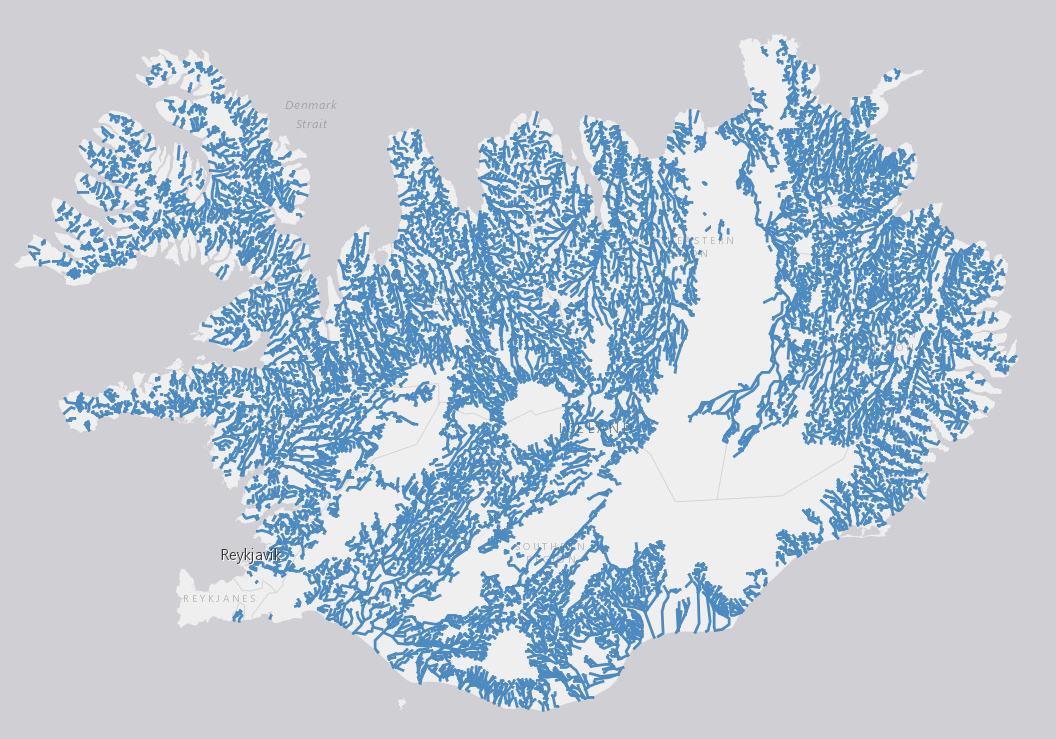
EN: River waterbodies in Iceland as reported to WISE on 22.12.2018. "River" means a body of inland water flowing for the most part on the surface of the land but which may flow underground for part of its course.For further description of dataset fields and field values see GML schema here: http://dd.eionet.europa.eu/schemas/WFD2016/GML_SurfaceWaterBodyLine_2016.xsd IS: Straumvatnshlot á Íslandi miðað við skil inn í WISE upplýsingakerfið þann 22.12.2018. Straumvatn er vatnsfall sem flæðir eftir og á yfirborði lands að mestu en getur að hluta til flætt neðanjarðar. Nánari lýsing á eigindum og gildum gagnasettsins má finna í GML skema hér: http://dd.eionet.europa.eu/schemas/WFD2016/GML_SurfaceWaterBodyLine_2016.xsd
-

Staðsetning á mælipunktum sem nýttir eru til að fylgjast með breytingum á jökulsporðum. Mælt af sjálfboðaliðum og/eða félögum JÖRFÍ
-
EN: Boundary of River Basin District(s) of Iceland as reported to WISE on 22.12.2018."River basin district" means the area of land and sea, made up of one or more neighbouring river basins together with their associated groundwaters and coastal waters, which is identified under Article 3(1) as the main unit for management of river basins.For further description of dataset fields and field values see GML schema here. http://dd.eionet.europa.eu/schemas/WFD2016/GML_RiverBasinDistrict_2016.xsd IS: Vatnaumdæmi Íslands miðað við skil inn í WISE upplýsingakerfið þann 22.12.2018. Vatnaumdæmi er stjórnsýslueining sem nær til íslenskra vatnasvæða ásamt árósavatni og strandsjó sem þeim tengjasteins og það er skilgreint í lögum nr. 35/2011 og reglugerð nr.935/2011 um Stjórn vatnamála. Nánari lýsing á eigindum og gildum gagnasettsins má finna í GML skema hér: http://dd.eionet.europa.eu/schemas/WFD2016/GML_RiverBasinDistrict_2016.xsd
-
Útlínur byggðar á kortlagningu á jökulgarða og annarra landforma sem jöklar skilja eftir. Einnig er byggt á rituðum heimildum, frásögnum heimamanna og ferðafólks, ljósmyndum og öðrum tiltækum gögnum. Um er að ræða niðurstöður margra rannsóknarhópa. Flestir jöklar náðu hámarksútbreiðslu í kringum 1890, en meðal undantekninga frá því er Drangajökull sem náði mestri útbreiðslu um miðja 19. öld.
-
Útlínur dregnar eftir uppréttum Sentinel-2 gervihnattamyndum. Uppréttar loftmyndir frá Loftmyndum ehf. og Landsat 8 gervihnattamyndir voru einnig notaðar á nokkrum stöðum.
-
Útlínur dregnar eftir uppréttum loftmyndum frá Loftmyndum ehf. og einnig eftir Landsat 8 gervihnattamyndum á nokkrum stöðum.