 Lýsigagnagátt
Open data
Type of resources
Available actions
Topics
INSPIRE themes
Keywords
Contact for the resource
Provided by
Years
Formats
Representation types
Update frequencies
status
Service types
Scale
-

This data includes all defined hiking trails within Vatnajökull National Park, and selected trails near the park. The trails are drawn from hiking maps that the park has published since it was founded in 2008. The maps have been updated regularly since, last update was in 2019, (Snæfell area and a large part of the western region). These hiking maps can be viewed by selecting “Hiking map, click on frame” in the Vatnajökull National Park Mapview, (see link below).
-

Boundaries of various areas within Vatnajökull National Park with special rules. 1. Esjufjöll, Jökulsárgljúfur, Skaftafell and Askja have special rules about camping restrictions, according to article 3, in regulation about Vatnajökull National Park, 300/2020. Coordinates are listed in table 2 in amendment IV in the regulation. 2. Hvannadalshnjúkur, Öræfajökull and Kverkfjöll have special limitations on, if and when motorized traffic is allowed. 3. Traditional land use areas are listed in article 26 of regulation about Vatnajökull National Park, 300/2020. Disclaimer: If there is a difference between the data and the regulation text, then the regulation text applies.
-
Í desember 2011 var ný geóíða reiknuð fyrir Ísland í samstarfi við DTU Space í Danmörku. Megin tilgangur þessara útreikninga var að reikna nýja og nákvæmari geóíðu af Íslandi og tengja hana við Landshæðarkerfi Íslands ISH2004. Nánari upplýsingar eru á heimasíðu Náttúrufræðistofnunar, nánar tiltekið hér: https://www.lmi.is/is/maelingar/grunnkerfi/geoida
-
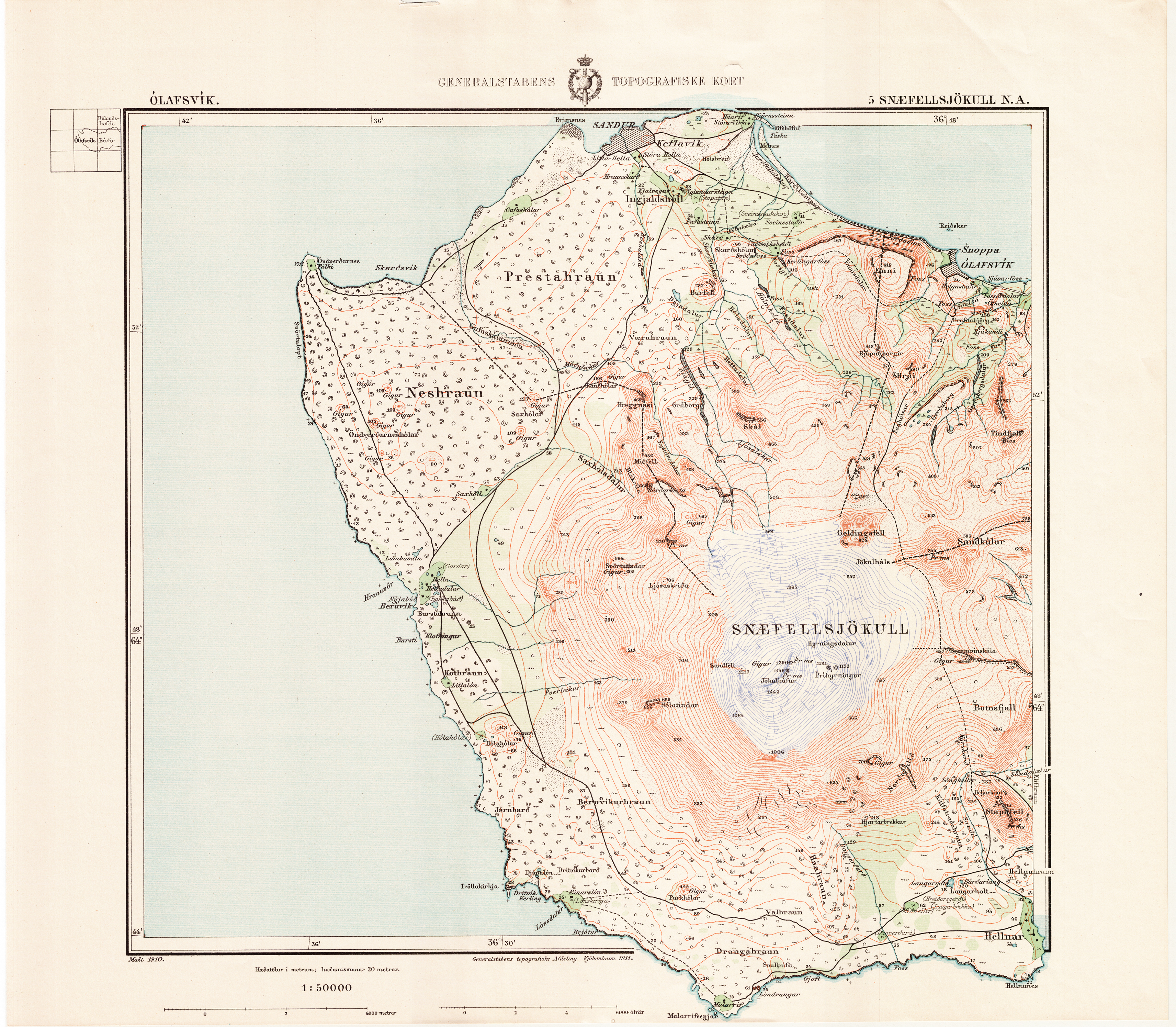
Um er að ræða vefkort sem var útbúið með því að staðsetja og klippa saman hin svokölluðu Herforingjaráðskort. Eftirfarandi lýsing á Herforingjaráðskortum er tekin af vef Landsbókasafns: Á síðasta áratug 19. aldar varð dönskum yfirvöldum ljóst að þau kort sem til voru af Íslandi stæðust ekki þær kröfur sem gera þyrfti í samfélagi þess tíma. Bestu kort af Íslandi sem buðust voru í stórum dráttum byggð á strandmælingum danska sjóhersins sem fram fóru á árunum 1801-1818 annars vegar og hins vegar á kortum Björns Gunnlaugssonar sem byggð voru á fyrrnefndum strandmælingum og eigin mælingum Björns á árunum 1831-1843. Á fjárlögum 1899 voru veittar 5000 krónur og skyldi hefja nýjar þríhyrninga- og strandmælingar á Reykjanesi. Árið 1900 var gefin út í Danmörku tilskipun um að sendur skyldi leiðangur til Íslands til að mæla hér grunnlínu og hnattstöðu. Síðan var ætlunin að mæla þríhyrninganet út frá nýju grunnlínunni. Hingað voru sendir danskir liðsforingjar og sumarið 1900 var unnin ýmis undirbúningsvinna. Árið 1902 höfðu fjárveitingar verið auknar svo að rétt þótti að hefjast handa. Byrjað var á Hornafirði og mælt vestur ströndina og um lágsveitir Suðurlands en uppsveitum og hálendi frestað. Verkinu var svo haldið áfram tvö næstu árin en féll niður 1905 vegna fjárskorts og annarra anna hjá Landmælingadeild danska herforingjaráðsins (Generalstabens topografiske Afdeling) er tókst verkið á hendur. Eftir eins árs bið var þráðurinn tekinn upp að nýju enda bættist nú við fjárstyrkur úr ríkissjóði Dana. Á árunum 1906-1914 var unnið öll sumur, nema 1909, þegar ekkert var aðhafst. Var þá lokið byggðamælingum sunnanlands og mælt um Vesturland, norður og austur um Húnaflóa. Árangurinn var 117 kortblöð af þriðjungi landsins, suður- og vesturhluta, í mælikvarða 1:50.000 (auk nokkurra sérkorta af afmörkuðum svæðum). Þau eru gjarnan nefnd herforingjaráðskortin í höfuðið á þeim sem stóðu fyrir gerð þeirra.
-

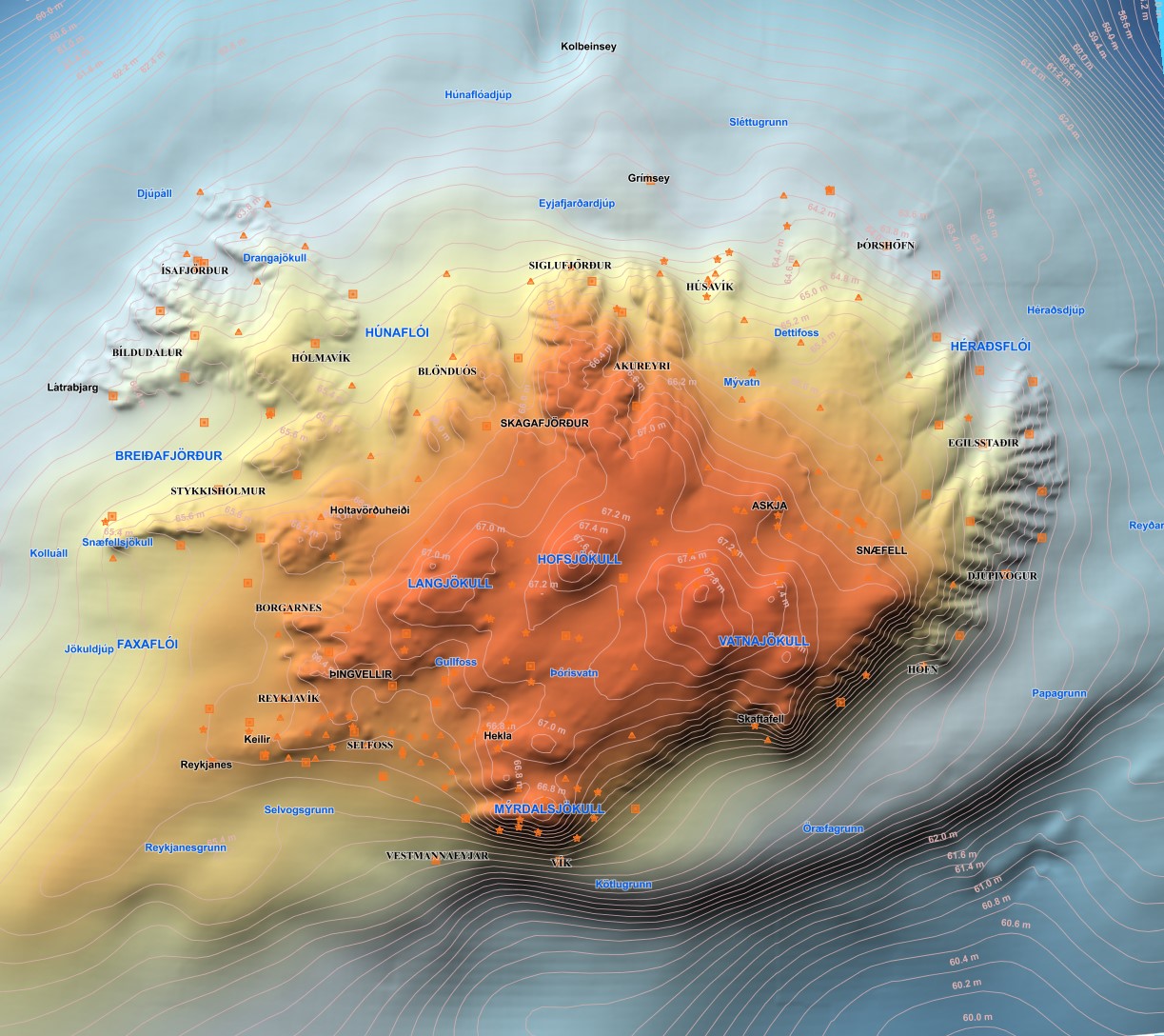
Bauganet jarðar byggist á ímynduðu hnitakerfi sem lagt er yfir jarðarkúluna og er notað til að gefa upp nákvæma staðsetningu á yfirborði jarðar. Breiddarbaugar eru notaðir til þess að ákvarða staðsetningu til norðurs eða suðurs og lengdarbaugar ákvarða staðsetningu til austurs eða vesturs. Hver gráða á lengdarbaug er að meðaltali 111,2 kílómetrar á lengd (um það bil 60 sjómílur) svo til að fá meiri nákvæmni er henni ýmist skipt í hundraðshluta (kommustafi) eða mínútur (60 hluta) og sekúndur (60*60 eða 360 hluta). Dæmi um hnit í bauganeti jarðar er 48°51′29″N, 2°17′40″A (Eiffelturninn í París) þar sem ' eru mínútur og " sekúndur.
-
Vefþjónn fyrir landfræðileg gögn Náttúrufræðistofnun. Hér eru nýjustu útgáfur gagna Náttúrufræðistofnun aðgengilegar. Vefþjónnin er byggður á opnum staðli OGC og hægt er að nálgast gögnin á vefþjóninum í gegnum ýmsar tegundir þjónusta, s.s. WFS, WMS, WMTS.
-

Vatnajökull National Park was founded on June 7th 2008, although the act on Vatnajökull National Park was entered into force on May 1st 2007. It is the largest national park in Iceland by far, 14,967 km2. Vatnajökull National Park was inscribed as a UNESCO World Heritage Site on July 5th 2019. The boundary of Vatnajökull National Park, after its latest expansion on September 22nd 2021. The boundary is drawn in accordance to regulation on Vatnajökull National Park, No 300/2020, with later amendments. Disclaimer: If there is a difference between the data and the regulation text, then the regulation text applies. The data also includes all previous boundaries of the national park as well as current boundaries of operating areas.
-
Average near-Up crustal velocities between summer 2015 and summer 2018. These velocities indicate velocities in the Up direction. However, they could be slightly influence by velocities along the East and North directions and are therefore called near-Up. Near-Up velocities were derived by decomposing the line-of-sight velocities of six Sentinel-1 interferometric time-series covering Iceland. These time-series used a single master approach and Sentinel-1 images from the following summers (mid-June to end of September): 2015, 2016, 2017, and 2018. The near-Up velocity grid has a 50 m resolution.
-
Average near-East crustal velocities between summer 2015 and summer 2018. These velocities indicate velocities in the East direction. However, they could be slightly influence by velocities along the North and Up directions and are therefore called near-East. Near-East velocities were derived by decomposing the line-of-sight velocities of six Sentinel-1 interferometric time-series covering Iceland. These time-series used a single master approach and Sentinel-1 images from the following summers (mid-June to end of September): 2015, 2016, 2017, and 2018. The near-East velocity grid has a 50 m resolution.
-

Abstract is not available in english