 Lýsigagnagátt
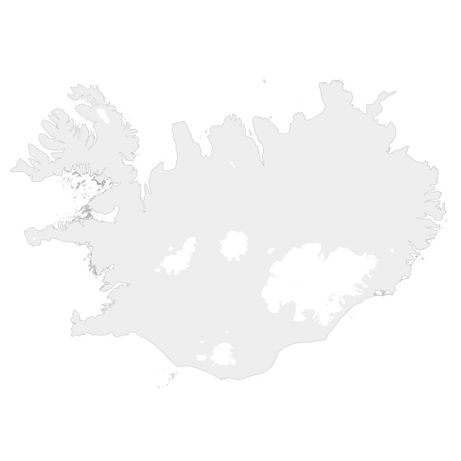
Útlínur Íslands
Simple
- Date ( Publication )
- 2017-09-19
- Purpose
- Gögnin/kortið var útbúið í þeim tilgangi að nota sem bakgrunnskort í Landupplýsingagátt.
- Status
- Completed
- Maintenance and update frequency
- Not planned
- Keywords ( Theme )
-
- Bakgrunnskort
- Opin gögn LMÍ
- Vefkort LMÍ
- Keywords ( Place )
-
- Ísland
- Access constraints
- Other restrictions
- Other constraints
- no limitations to public access
- Use constraints
- Copyright
- Other constraints
- Attribution 4.0 International (CC BY 4.0)
- Spatial representation type
- Vector
- Metadata language
- is
- Character set
- UTF8
- Topic category
-
- Imagery base maps earth cover
))
- Reference system identifier
- 5325
- Distribution format
-
-
GeoTIFF
(
1.0
)
-
GML
(
3.2.1
)
-
KML
(
)
-
ZIP
(
)
-
PDF
(
)
-
GeoTIFF
(
1.0
)
- OnLine resource
- Heimasíða Náttúrufræðistofnun ( WWW:LINK-1.0-http--link )
- OnLine resource
- Landupplýsingagátt / Geoportal ( WWW:LINK-1.0-http--link )
- OnLine resource
-
LMI_Island_einfalt
(
OGC:WMS-1.1.1-http-get-capabilities
)
ISN93
- OnLine resource
-
LMI_Island_einfalt
(
OGC:WMS
)
WMS Web Mercator
- OnLine resource
-
LMI_Island_einfalt
(
OGC:WMS
)
ISN2016
- OnLine resource
- Um opin gögn NÁTT ( WWW:LINK-1.0-http--link )
- OnLine resource
-
LMI_Island_einfalt
(
OGC:WMTS
)
WMTS dæmi
- Hierarchy level
- Dataset
- Statement
- Bakgrunnskortið er unnið úr IS 50V Strandlína og IS 50V Vatnafar, þaðan sem helstu jöklar voru teknir.
gmd:MD_Metadata
- File identifier
- 501d07cf-2e8c-4115-9690-de6663a220c5 XML
- Metadata language
- is
- Character set
- UTF8
- Parent identifier
- IS 50V Strandlína FE3E66F8-7749-409A-8795-02207CE27613
- Date stamp
- 2026-05-12T11:31:42
- Metadata standard name
- ISO 19115:2003/19139
- Metadata standard version
- 1.0
Overviews
Spatial extent
Provided by
