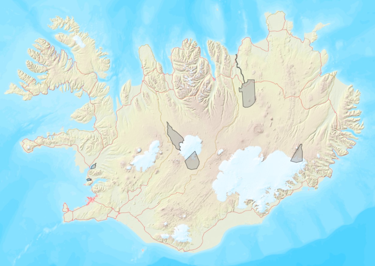
Ramsarsvæði á Íslandi
Ramsarsvæði eru votlendissvæði í heiminum sem njóta sérstakrar verndar.
Simple
- Date ( Publication )
- 2020-10-21
- Keywords
-
- INSPIRE
- GSL flokkun ( Theme )
- GEMET - INSPIRE themes, version 1.0 ( Theme )
- Access constraints
- Other restrictions
- Other constraints
- no limitations to public access
- Use constraints
- Other restrictions
- Other constraints
- Attribution 4.0 International (CC BY 4.0)
- Spatial representation type
- Vector
- Denominator
- 50000
- Metadata language
- en
- Topic category
-
- Environment
- Inland waters
- Boundaries
N
S
E
W
))
- Reference system identifier
- EPSG / 3057
- Distribution format
-
-
ESRI Shapefile
(
1.0
)
-
ESRI Shapefile
(
1.0
)
- OnLine resource
- Ramsarsvæði ( WWW:LINK-1.0-http--link )
- OnLine resource
- Landupplýsingagátt ( WWW:LINK-1.0-http--link )
- OnLine resource
-
fridlyst_svaedi:v_ramsar
(
OGC:WMS-1.3.0-http-get-capabilities
)
fridlyst_svaedi:v_ramsar
- OnLine resource
-
fridlyst_svaedi:v_ramsar
(
OGC:WFS-2.0.0-http-get-capabilities
)
fridlyst_svaedi:v_ramsar
- Hierarchy level
- Dataset
Domain consistency
Conformance result
- Date ( Publication )
- 2016-03-24
- Explanation
- Validation has not been performed.
- Pass
- No
Conformance result
- Date ( Publication )
- 2010-12-08
- Explanation
- Validation has not been performed.
- Pass
- No
- Statement
- source
gmd:MD_Metadata
- File identifier
- 6e2bcb25-4d42-4f1e-bc32-b2375f4f17d8 XML
- Metadata language
- en
- Hierarchy level
- Dataset
- Date stamp
- 2022-05-27T14:50:59
- Metadata standard name
- INSPIRE Metadata Implementing Rules
- Metadata standard version
- Technical Guidelines based on EN ISO 19115 and EN ISO 19119 (Version 1.2)
Overviews

Smámynd úr Landupplýsingagátt
Spatial extent
N
S
E
W
))
Provided by

Associated resources
Not available
 Lýsigagnagátt